The Best Hikes in Big Bend National Park
Ranked in three bands by the vertical each source measures, because no one number reaches every item here, then vote the order into shape. Where an article names and measures its trail, that entry leads, and Emory Peak and Lost Mine Peak both do. The middle band runs on documented relief, the "rises X feet in Y miles" figure each summit carries, biggest first. Boquillas Canyon belongs there too, though its 1,500 feet of limestone stands over you rather than under. The closing three measure no vertical at all, so they go in the order their own articles give them: a spring you can still soak in, a ghost town, a ruin. No trail gets named here unless its own source names it, which is why several entries describe a destination and stop there. Left off: the park itself, and the Chisos range as a single entry, since so much of what follows sits inside it. Summer in this desert is genuinely dangerous.
Emory Peak is #1 on “The Best Hikes in Big Bend National Park”.
- 1
Emory Peak
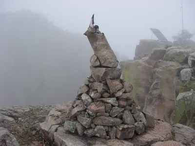
Park high point at 7,825 feet, and about 2,500 feet of gain to earn it. The Emory Peak Trail itself runs roughly 1.5 miles; you reach its start by climbing the Pinnacles Trail 3.5 miles from the Chisos Basin trailhead. The finish is the part to plan for, because a semi-technical rock scramble sits between the base of the summit block and the top.
 Emory Peak - Wikipediahttps://en.wikipedia.org/wiki/Emory_Peak
 - 2
Lost Mine Peak
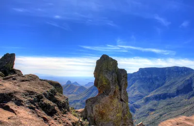
Built in the 1930s by the Civilian Conservation Corps, the Lost Mine Trail is the most popular walk in Big Bend, and the numbers stay friendly at 4.8 miles round trip and 1,000 feet of gain. The name comes from a legend of Spanish explorers who found silver here and enslaved local people to dig it, then lost the entrance when the workers rebelled and sealed it behind them.
 Lost Mine Peak - Wikipediahttps://en.wikipedia.org/wiki/Lost_Mine_Peak
 - 3
Townsend Point
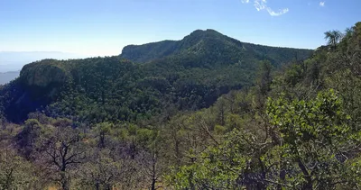
Juniper Canyon lies 3,250 feet below the summit, two miles out, and that ratio is the whole argument for coming. At 7,574 feet this is the second-highest ground in Big Bend. The toponym was adopted in 1981 for Everett Ewing Townsend, who was responsible for founding the park, so climb it and you are climbing his memorial. Carry more water than you think the day needs.
 Townsend Point - Wikipediahttps://en.wikipedia.org/wiki/Townsend_Point
 - 4
Toll Mountain
Fourth-highest peak in Big Bend at 7,409 feet, and the ground rises 2,600 feet above Juniper Canyon inside a single mile. Its toponym was adopted in 1948 for Roger W. Toll, a National Park Service official who ran Yellowstone and was instrumental in establishing this park. Meet it first from Emory Peak, where the flat top sits centered in the view northeast.
 Toll Mountain - Wikipediahttps://en.wikipedia.org/wiki/Toll_Mountain
 - 5
Ward Mountain
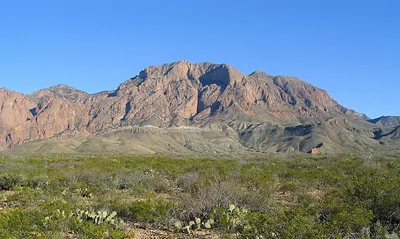
West side of the Chisos, 6,926 feet, and the climb is the point: 2,500 feet up out of Cottonwood Creek near Ward Spring in 1.25 miles. Johnny Ward was a cowboy on the neighboring G4, one of the first large ranches of Big Bend, stretching from Oak Spring and The Window west to Terlingua Creek and Aguja Fria.
 Ward Mountain (Texas) - Wikipediahttps://en.wikipedia.org/wiki/Ward_Mountain_(Texas)
 - 6
Vernon Bailey Peak
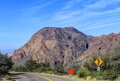
Half a mile of horizontal, 2,070 feet of vertical: that is what Oak Canyon puts between you and a 6,672-foot top. The peak was named in 1945 for Vernon Orlando Bailey, the naturalist behind the biological surveys of Texas, New Mexico, North Dakota and Oregon, a career spent mapping country that looks exactly like this.
 Vernon Bailey Peak - Wikipediahttps://en.wikipedia.org/wiki/Vernon_Bailey_Peak
 - 7
Casa Grande Peak
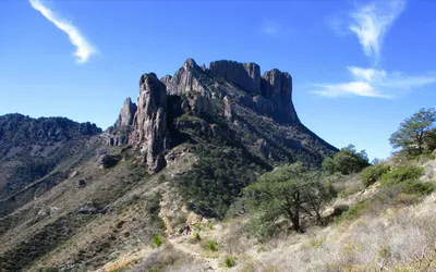
You see this one from the Chisos Basin before you see anything else, and the reason is 2,000 feet of rock stacked over the Basin floor inside a mile. The summit tops out at 7,325 feet. The name is Spanish for 'big house', adopted in 1939 because the profile resembles a large castle, and once you have picked out the castle you cannot stop seeing it.
 Casa Grande Peak - Wikipediahttps://en.wikipedia.org/wiki/Casa_Grande_Peak
 - 8
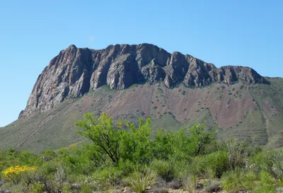
Nugent Mountain
Drivers pass under it without a second look. From the Rio Grande Village Road it is 1,600 feet up in a mile to a 4,778-foot top, and the rock you climb is intrusive igneous from the Oligocene, magma that cooled underground and got uncovered later. The name has been turning up in print since at least 1913.
 Nugent Mountain - Wikipediahttps://en.wikipedia.org/wiki/Nugent_Mountain
 - 9
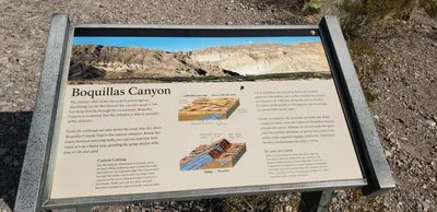
Boquillas Canyon
Scale arrives all at once at the mouth: walls 1,500 feet high, cut through thick layers of limestone, with the Rio Grande running up to Class II beneath them. The length is genuinely unsettled, with estimates running from 5 miles to 17 depending on where you decide the canyon ends. 'Boquillas' means 'little mouths' in Spanish, probably for that narrow entrance.
 Boquillas Canyon - Wikipediahttps://en.wikipedia.org/wiki/Boquillas_Canyon
 - 10
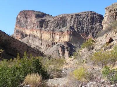
Burro Mesa
Modest by the park's standards at 4,434 feet, with 1,200 feet of it standing over Javelina Wash a mile away. What is underfoot is the reason to bother: 29-million-year-old Oligocene rock, Burro Mesa Rhyolite lying over Wasp Spring Tuff, with Quaternary sediment on top. The Burro Mesa fault is exposed along the northeast flank. Wild burro herds gave the place its name.
Burro Mesa - Wikipediahttps://en.wikipedia.org/wiki/Burro_Mesa - 11
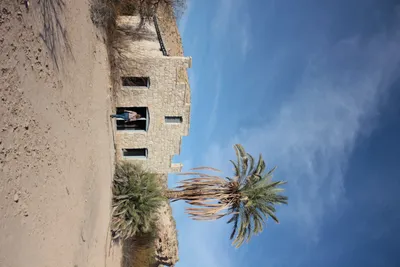
Big Bend Hot Springs
J.O. Langford started developing the springs in 1909, left in 1912 when bandits made the area unsafe, and came back in 1927 to rebuild the bathhouse under a canvas roof. He also put up a store and a motor court of seven attached cabins. Water surfaces at 105 degrees Fahrenheit and can still be soaked in, when the Rio Grande is not sitting on top of it, which happens often. The historic Comanche Trail passed nearby.
 Hot Springs (Big Bend National Park) - Wikipediahttps://en.wikipedia.org/wiki/Hot_Springs_(Big_Bend_National_Park)
 - 12
Castolon Historic District
Adobe walls under corrugated metal roofs, and a store that went up in 1901, built by Cipriano Hernandez and now known as the Alvino House. The Army finished a border camp here in 1920 and never used it, the border having gone quiet. La Harmonia took over the barracks in 1921 and traded until 1961. It is a tourist ghost town now, and a fire out of Mexico heavily damaged the store on 22 May 2019.
 Castolon - Wikipediahttps://en.wikipedia.org/wiki/Castolon_Historic_District
 - 13
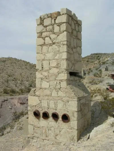
Mariscal Mine
Cinnabar turned up here in 1900, found by the rancher Martin Solis, and the site went on to yield 1,400 flasks of mercury at 76 pounds each. The refining plant sits below the main shaft entrance in the side of Mariscal Mountain, and it is ruinous now: holding bins, furnace, condensing chambers and stack, all roofless and doorless.
 Mariscal Mine - Wikipediahttps://en.wikipedia.org/wiki/Mariscal_Mine
How this list was ranked
Readers rank this list by voting items up and down. Items are ordered by reader votes.