
The Most Walkable Cities in America
Rank the American cities where your feet do the work, then vote the order into shape. Eligibility is simple. US cities, nothing outside the country. One question sets the order: how much of the city can you use without a car? Coverage is the test, so a place where one glorious mile carries the whole reputation lands below a plainer city you can live in without keys. Walk Score belongs to a private company and no number of theirs appears here; this is a judgement rather than an index, and every entry names what made the place walkable and where the walking gives out. Charleston and Savannah are the clearest cuts: in each the walking is one historic district and the rest of the city needs a car. Seattle, Portland, Minneapolis and Miami placed below the cut on the same question.
Hoboken, New Jersey is #1 on “The Most Walkable Cities in America”.
- 1
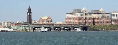
Hoboken, New Jersey
One square mile and a quarter of land, carrying more than 42,400 people per square mile in the 2010 census. John Stevens' Hoboken Land and Improvement Company laid the streets, blocks and lots out before he died in 1838, at a scale that predates the automobile by seventy years. There is no part of it you cannot use on foot. Errands end at Hoboken Terminal, the national historic landmark on the city's southeastern corner.
 Hoboken, New Jersey - Wikipediahttps://en.wikipedia.org/wiki/Hoboken,_New_Jersey
 - 2

Cambridge, Massachusetts
Six and a half square miles of land, founded in December 1630, and almost none of it drawn for a car. The place calls itself the City of Squares because its commercial districts are street junctions rather than strips, and Harvard Square is the junction of Massachusetts Avenue with Brattle, Dunster and JFK Streets. Cross the whole city in an afternoon and you never leave a sidewalk with something on it.
 Cambridge, Massachusetts - Wikipediahttps://en.wikipedia.org/wiki/Cambridge,_Massachusetts
 - 3

San Francisco
Hills are the objection everyone raises, and the city answered it in 1873, when the first cable cars carried San Franciscans up Clay Street. After the 1906 disaster, San Franciscans rejected calls to remake the street grid completely and rebuilt on the old lines for speed, which is why the grid runs corner to corner and a shop still sits at the end of so many blocks. More than 50 hills, all of them gridded.
 San Francisco - Wikipediahttps://en.wikipedia.org/wiki/San_Francisco
 - 4
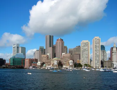
Boston
Puritan settlers put the town on the Shawmut Peninsula in 1630, which is why the downtown streets behave like footpaths that hardened. It ranks third-most densely populated among large American cities, and even the flat part was invented: in the mid-to-late 19th century workers filled almost 600 acres of Charles River marshland west of Boston Common with gravel railed in from Needham Heights. That fill is Back Bay.
https://en.wikipedia.org/wiki/Boston - 5

Providence, Rhode Island
Roger Williams settled it in June 1636, and the city limits still enclose a total area of 20.5 square miles, small enough that a resident can reach most of it on foot. The East Side holds the largest contiguous area of buildings on the National Register of Historic Places in the United States, many of them pre-revolutionary houses. Downtown, riverwalks run past the Waterplace Park amphitheater, and the climb up from there takes minutes.
 Providence, Rhode Island - Wikipediahttps://en.wikipedia.org/wiki/Providence,_Rhode_Island
 - 6

Philadelphia
William Penn's surveyor Thomas Holme drew the plan in 1682, with five open squares set at the compass points; Southwest Square is now Rittenhouse Square, and Southeast became Washington. Center City still runs long straight streets between the Delaware and the Schuylkill, and for most of the city's history the typical home has been the row house, which is why the coverage extends far past downtown. Northeast Philadelphia is where the grid gives out.
 Philadelphia - Wikipediahttps://en.wikipedia.org/wiki/Philadelphia
 - 7

Baltimore
Tens of thousands of rowhouses line a grid and spoke street pattern here, and the mix of brick and formstone facings is the city's look across 80.9 square miles of land. The town was founded on the west side of the Jones Falls on August 8, 1729; Jonestown and Fells Point were folded in by 1797. Patterson Park and Druid Hill Park sit inside that fabric, and you walk to them.
 Baltimore - Wikipediahttps://en.wikipedia.org/wiki/Baltimore
 - 8
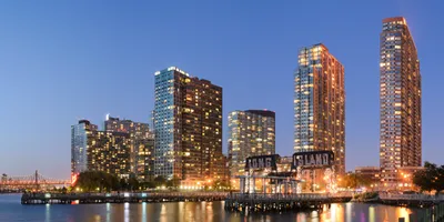
New York City
Walking and cycling account for 21% of all trips taken here, against a rate of about 8% across American metro regions. The Commissioners' Plan of 1811 pushed the street grid across almost all of Manhattan, and the subway that opened in 1904 bound the rest together. Staten Island and the outer edges of Queens are what keep it off the top of this list; the grid thins there and a car starts to make sense again.
https://en.wikipedia.org/wiki/New_York_City - 9

Washington, D.C.
Pierre Charles L'Enfant designed the capital in 1791, splitting it into four quadrants that meet at the Capitol Building. The federal Height of Buildings Act of 1910 then tied building height to the width of the adjacent street, capping commercial streets at 130 feet and residential ones at 90, which is why the center never pulled apart into towers and parking. East of the Anacostia the streets go car-scale.
https://en.wikipedia.org/wiki/Washington,_D.C. - 10
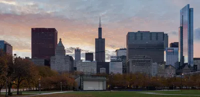
Chicago
Bungalow country does the heavy lifting here: large swaths of the residential city away from the lake are brick bungalows built from the early 20th century through the end of World War II, on blocks drawn for streetcars. The Plan of Chicago recommended many more diagonal streets, and the Ogden Avenue extension was the one that got constructed, so the grid stayed a grid, at the cost of very long blocks.
https://en.wikipedia.org/wiki/Chicago - 11
Jersey City, New Jersey
Incorporated in 1838 and holding 14.74 square miles of land, with a downtown built around two square parks, Van Vorst Park and Hamilton Park, both ringed by brownstones. The Grove Street PATH station sits inside that fabric and has been renovated to be fully ADA compliant. The catch is the western half, where highways and rail yards chop the grid up, and half a city on foot is half a city.
https://en.wikipedia.org/wiki/Jersey_City,_New_Jersey - 12
Pittsburgh
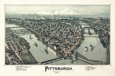
Eight hundred sets of outdoor public stairways, 44,645 treads in total, exist because a street grid cannot climb what this city is built on. Incorporated as a borough on April 22, 1794, it spreads 90 neighborhoods across 55.6 square miles of land, split by three rivers and 446 bridges. The walking inside any one neighborhood is superb, and getting between two of them is where the coverage breaks.
 Pittsburgh - Wikipediahttps://en.wikipedia.org/wiki/Pittsburgh
 - 13
New Orleans
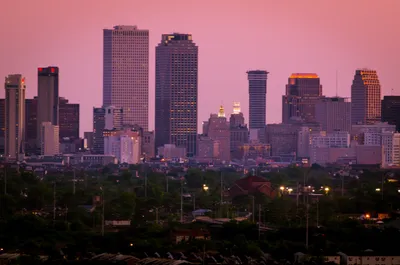
Military engineers Adrien de Pauger and Pierre Le Blond de Tour laid out the street grid after the founding in the spring of 1718, and it has outlasted nearly everything built on it. Almost all the surviving 18th-century architecture of the Vieux Carré is Spanish-period work, the Old Ursuline Convent excepted. Leave the Quarter along St. Charles Avenue and the streetcar picks you up. Then there is New Orleans East.
 New Orleans - Wikipediahttps://en.wikipedia.org/wiki/New_Orleans
How this list was ranked
Readers rank this list by voting items up and down. Items are ordered by reader votes.